Maps & Data

Official Waterway GIS
& Monitoring Portals

To ensure complete accuracy, we recommend accessing the live, official GIS mapping databases and testing networks managed by Broward County, the USGS, and Miami Waterkeeper.

🔎
Accuracy Notice: Rather than relying on static or approximated map graphics, community advocacy is best served by accessing real-time, interactive databases directly from the environmental authorities.

Upper North Fork Waterway Aerial Overview

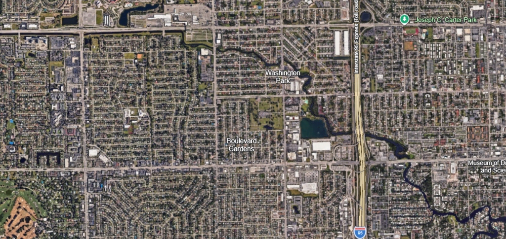
This Google Earth satellite view shows the winding geometry of the upper North Fork. The channel snakes from the northwest (left) through residential canals in Boulevard Gardens and Washington Park, crossing directly beneath the Interstate 95 corridor.
SATELLITE CORRIDOR ANALYSIS (UPPER REACHES)
Source: Google Earth Aerial Imagery
Key Crossings: I-95 Expressway
Google Earth satellite imagery showing the winding upper North Fork river channel passing under I-95
Restoration & Recreation Areas: Notice the tight, winding loops of the river channel. Stagnation occurs primarily in the dead-end canal loops to the west of I-95, making flow dredging near Washington Park and Sweeting Park essential. Replanting foliage along these banks will help stabilize soil and filter stormwater runoff before it enters the channel.

Lower North Fork Satellite Overview

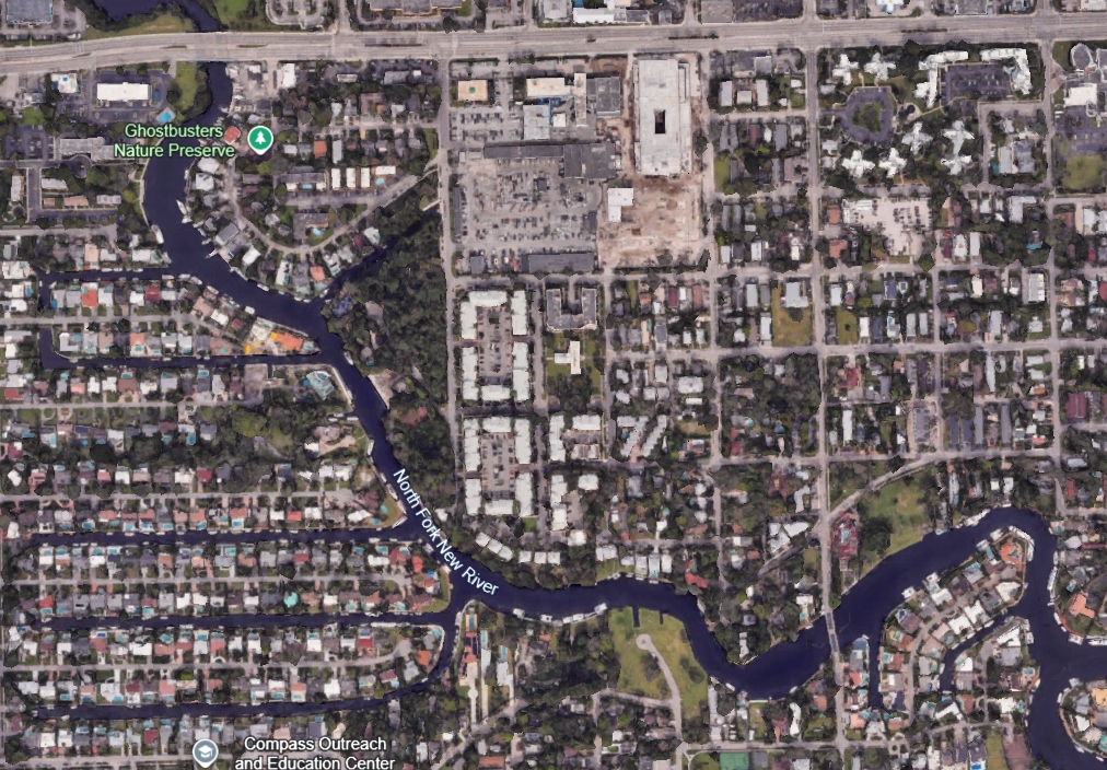
This view covers the southern stretch of the North Fork from its confluence with the main New River (bottom right) winding northwest up to Broward Boulevard (top).
SATELLITE CORRIDOR ANALYSIS (LOWER REACHES)
Source: Google Earth Aerial Imagery
Key Thresholds: Broward Blvd Fixed Bridge
Google Earth satellite imagery showing the lower North Fork river corridor running up to Broward Blvd
Navigational Clearance & Ecology: The southern section of the North Fork (connecting to the main New River) is wide and deep enough to accommodate larger vessels, yachts, and sailboats. However, navigation is strictly restricted further north once you reach the low fixed bridge at Broward Boulevard. Past this barrier, the waterway is navigable only by smaller recreational crafts such as kayaks, canoes, and small motorboats. Features of ecological interest include the Ghostbusters Nature Preserve, representing localized green conservation efforts along the winding upper banks.

Middle North Fork Satellite Overview

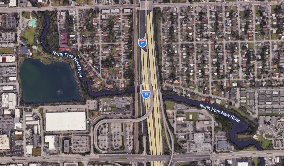
This view covers the section of the North Fork of the New River running from Broward Boulevard up to Sistrunk Boulevard.
SATELLITE CORRIDOR ANALYSIS (MIDDLE REACHES)
Source: Google Earth Aerial Imagery
Key Features: Delevoe Park & Lake
Google Earth satellite imagery showing the middle North Fork river corridor from Broward Blvd to Sistrunk Blvd
Ecology & Flow Concerns: As the river moves north of Broward Boulevard towards Sistrunk Boulevard, it becomes significantly more shallow. This segment faces severe water quality challenges, characterized by low water flow and a lack of active tidal flushing. Field inspections document copious amounts of floating garbage and overgrown, unmanaged shoreline foliage that chokes the channel. The area features Delevoe Park (with its large adjacent lake, visible on the left), representing a major recreational park that could be activated for community boating and kayaking once garbage cleanup and dredging restore the water's flow and clarity.

Upper-Middle North Fork Satellite Overview

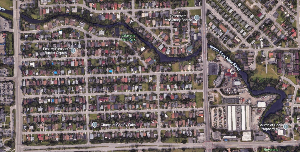
This view covers the section of the North Fork winding from Sistrunk Boulevard up to 31st Avenue.
SATELLITE CORRIDOR ANALYSIS (UPPER-MIDDLE REACHES)
Source: Google Earth Aerial Imagery
Key Landmarks: Lafayette Hart Park
Google Earth satellite imagery showing the upper-middle North Fork river corridor from Sistrunk Blvd to 31st Ave
Hidden Neighborhood Corridor: Winding primarily through residential blocks and occasional light commercial lots, this section of the river is largely out of sight and out of mind for the broader public. Because of this isolation, the channel suffers from a profound lack of maintenance and public attention. Hydrologically, it experiences severely degraded water flow, low dissolved oxygen, and accumulated historic waste pollution. Lafayette Hart Park (located in the upper center bend) represents a local recreational asset situated directly along these stagnant waters, highlighting the urgent need for municipal cleanup and restoration.

Headwaters & Swap Shop Corridor

This satellite view covers the northernmost headwaters of the North Fork winding from 31st Avenue up to the Fort Lauderdale Swap Shop property.
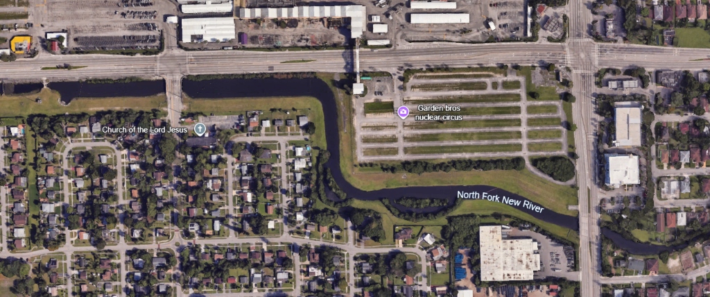
SATELLITE CORRIDOR ANALYSIS (HEADWATERS)
Source: Google Earth Aerial Imagery
Flow Control: C-21 Canal Gate
Google Earth satellite imagery showing the North Fork headwaters from 31st Ave to the Swap Shop property
Hydrology & Historical Pollution: In the upper left of the image, the flood control barrier restricts or opens water flow from the C-21 canal feed, controlling the headwater flushing velocities. This section runs directly adjacent to the Swap Shop (visible with its expansive drive-in structures), which historically housed exotic circus animals, may have contributing to animal waste runoff. Additionally, the channel lies just blocks away from a closed, historical waste treatment facility which may have utilized the river for water and waste disposal. Restoring flow from the C-21 canal and addressing sediment deposits in this section is critical to resolving downstream bacterial problems.
πŸ—ΊοΈ

Broward GeoHub Portal

Broward County's official GIS mapping platform. Search for "North Fork New River" to overlay zoning, stormwater drainage networks, aerial photography, and land-use layers.

Open Broward GeoHub
πŸ’§

Live Pathogen Map

View weekly, color-coded Enterococci bacterial testing results for Sweeting Park on the North Fork, updated directly by Miami Waterkeeper.

View Swim Guide Map
πŸ“Š

USGS Flow Gauge Station

Access live gauges, discharge volumes, and historical water quality index metrics for USGS Gauge Station #260743080103100 on the North Fork.

Open USGS Water Data

How to Request Specialized Spatial Data

Detailed hydrographic, bathymetric (depth), and flow studies are generated during active public works planning. You can request specific shapefiles, reports, or AutoCAD maps from the county and city planning offices:

Broward County GIS Unit

Request shapefiles or maps directly from the county mapping team.

Email: bcgis@broward.org

Broward Environmental Department

Request Technical Reports including DPEP 03-07 Operational Flow Studies.

Phone: 954-519-1270